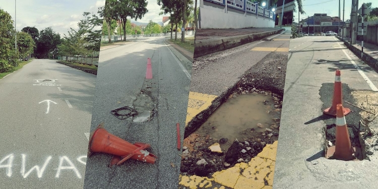
In order to fix the potholes that plague the roads in Selangor, the state government will be implementing the Smart Road Asset Management System (SRAMS). The primary function of the system is to deploy drones equipped with 360-degree cameras to monitor and identify damaged roads which are then relayed back to local authorities.
Selangor Menteri Besar Dato’ Seri Amirudin Shari said the SRAMS system will be combined with the Intelligent Response Selangor (IRS) to allow public road users to report potholes they encounter. Users will also be given the option to attach pictures to the report. Alternatively, Amirudin also said that the public will soon be able to make reports on social media using dedicated hashtags.
Moreover, the system will also accept reports on lights – I presume he meant streetlights – traffic lights, and road dividers.
At the moment, the system will be utilised by the Selangor Public Works Department but will be expanded to other Selangor State Local Authorities. “We will see how it goes, perhaps by the middle of the year we will begin to combine the system with all PBTs, as for the time being it is still with the Selangor Public Works Department,” Amirudin said with uncertainty. For now, the earliest the system will be available for the other Selangor State Local Authorities is sometime in June.
He also added that the goal of SRAMS is to standardise assent and road maintenance. At the moment, potholes on roads under the Selangor State Local Authorities can be easily reported via Waze. So why not expand on implementing Waze to standardise road maintenance?
Here’s why Waze is still better
Waze is among the popular navigation apps here in Malaysia, as such it can be found on almost every road user’s smartphone. Waze allows for quick and easy reporting within the app itself, not to mention the fact that the app is already open and running. The location of the pothole will be automatically geotagged and sent to the relevant authorities.
It was so seamless to use that from August 2017 to June 2020, there were more than 100,000 reports regarding road-related issues. According to Senator Edry Faizal on Twitter, 69.51% of the issues have been resolved with 22.13% of the issues were being worked on. Only 8.36% of them were yet to be addressed as of 28th December 2020.
Waze also relies on crowdsourced data, so there is no need to invest in equipment like drones, 360-degree cameras and to train the software to identify potholes using machine learning. Furthermore, there will be no need to maintain separate systems like SRAMS and IRS.
Even with all the advantages clearly laid out, a lot of our local authorities don’t seem to be getting on board with Waze for cities programme. They would rather choose to introduce multiple different channels to report potholes and other road-related matters. For instance, the Public Works Department (JKR) shared 11 different ways the public can report road-related issues. But none of those 11 ways is as easy, efficient or seamless to use as Waze.
On the other hand, Kuala Lumpur City Hall (DBKL) and Ipoh City Council (MBI) provide a WhatsApp hotline for users to send in their complaints. DBKL also specifies that you will need to snap a picture of the potholes. This would require you to stop the car by the side of the road and navigate a busy street to snap the picture. Then, there is the issue of poor lighting conditions at night. Are you expected to drive all the way back to the pothole the next day just to snap a clear picture?
[ SOURCE ]


