• 中文版
  • BM
  • News
  • Deals
  • Reviews
    • First Impressions
    • Hands-on
    • Comparisons
  • Tech
    • Mobile
    • Computers
    • Cameras
    • Wearables
    • Audio
    • Drones
  • Telco
    • Celcom
    • Digi
    • Maxis
    • Time
    • Tune Talk
    • U Mobile
    • Unifi
    • Yes
  • Cars
  • Contribute
  • Jobs
Menu
  • 中文版
  • BM
  • News
  • Deals
  • Reviews
    • First Impressions
    • Hands-on
    • Comparisons
  • Tech
    • Mobile
    • Computers
    • Cameras
    • Wearables
    • Audio
    • Drones
  • Telco
    • Celcom
    • Digi
    • Maxis
    • Time
    • Tune Talk
    • U Mobile
    • Unifi
    • Yes
  • Cars
  • Contribute
  • Jobs
Search
  • Tech
    • News
    • Mobile
    • Computers
    • Cameras
    • Wearables
    • Audio
    • Drones
  • Telco
    • Celcom
    • Digi
    • Maxis
    • Time
    • U Mobile
    • Unifi
    • Yes
  • Reviews
    • First Impressions
    • Hands-on
    • Comparisons
  • Buyer’s Guide
  • Opinions
  • Digital Life
  • Video
  • Deals
  • How-To
  • Cars
  • Bahasa Melayu
  • EV
  • Contribute
  • Advertise
Menu
  • Tech
    • News
    • Mobile
    • Computers
    • Cameras
    • Wearables
    • Audio
    • Drones
  • Telco
    • Celcom
    • Digi
    • Maxis
    • Time
    • U Mobile
    • Unifi
    • Yes
  • Reviews
    • First Impressions
    • Hands-on
    • Comparisons
  • Buyer’s Guide
  • Opinions
  • Digital Life
  • Video
  • Deals
  • How-To
  • Cars
  • Bahasa Melayu
  • EV
  • Contribute
  • Advertise
Search
Close
Home Digital Life

Google Maps will soon display COVID-19 cases in your area

  • BY Dzamira Dzafri
  • 25 September 2020
  • 11:09 am
  • Comment
Share on FacebookShare on Twitter

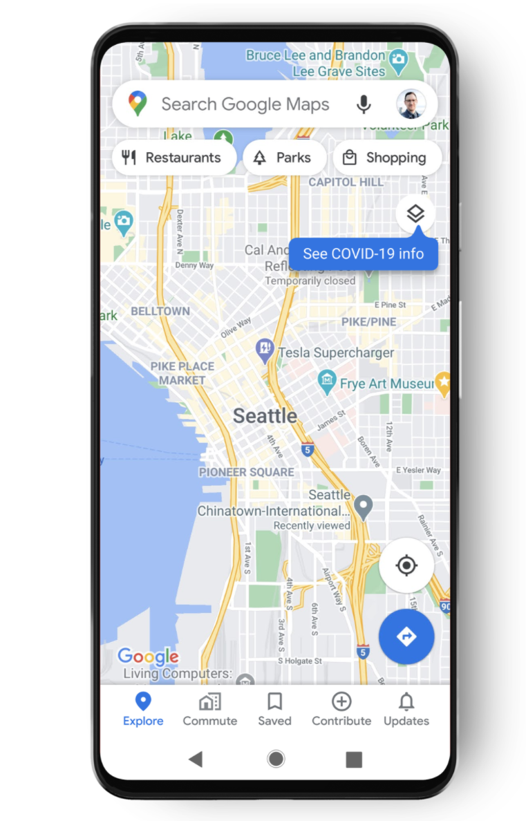
You’ll soon get a new and easy way to access information on COVID-19 spread through Google Maps (iOS, Android). The feature is expected to roll out this week.

“More than one billion people turn to Google Maps for essential information about how to get from place to place–especially during the pandemic when safety concerns are top of mind… This week, we’re introducing the COVID layer in Maps, a tool that shows critical information about COVID-19 cases in an area so you can make more informed decisions about where to go and what to do,” wrote Sujoy Banerjee, the Product Manager of Google Maps.

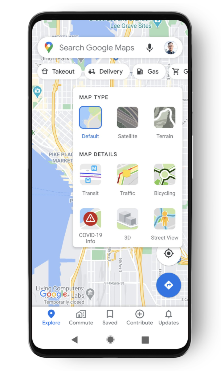
How to access the COVID layer on Google Maps

Keep in mind that as of today, the feature hasn’t yet been available on my own device. However, since Google said that it is expected to launch worldwide on Android and iOS devices by this week, it should be available soon. Still, here’s how to access the feature when it does appear on the app.

  • Open up Google Maps
  • Tap on the layers button on the top right hand corner of your screen (the icon that looks like stacked pieces of paper)
  • Tap on “COVID-19 info” under Map Details

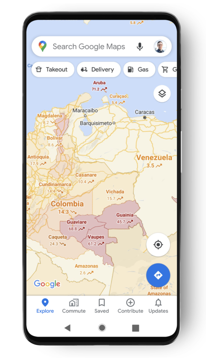
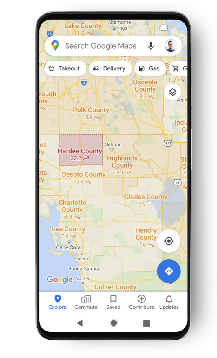
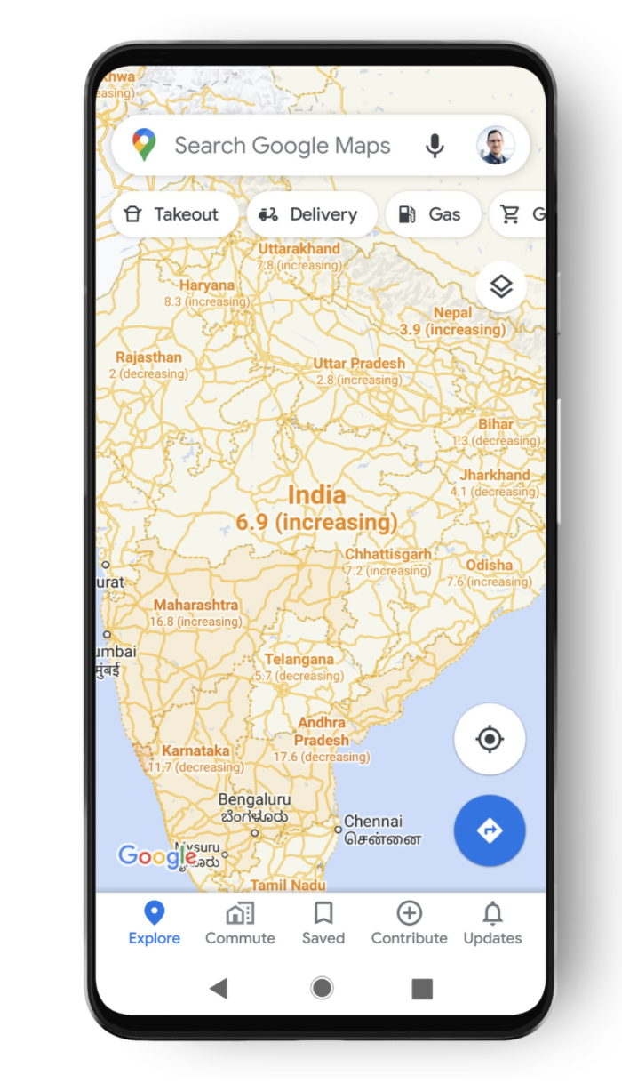
The COVID-19 layer in the Maps app will show the seven-day average number of confirmed cases in each area per 100,000 people. There will be areas of the map that are colour-coded based on case rate, as well as a label that shows if cases are going up or down. 

According to Banerjee, the trending case data is visible at the country level for all 220 countries and territories that Google Maps supports. But only certain countries will get more detailed information based on state or province, county, and city-level data.

The data comes from multiple authoritative sources—including Johns Hopkins, the New York Times, and Wikipedia. These sources get data from public health organisations like the World Health Organisation (WHO), government health ministries, as well as state and local health agencies and hospitals.

Source: Google

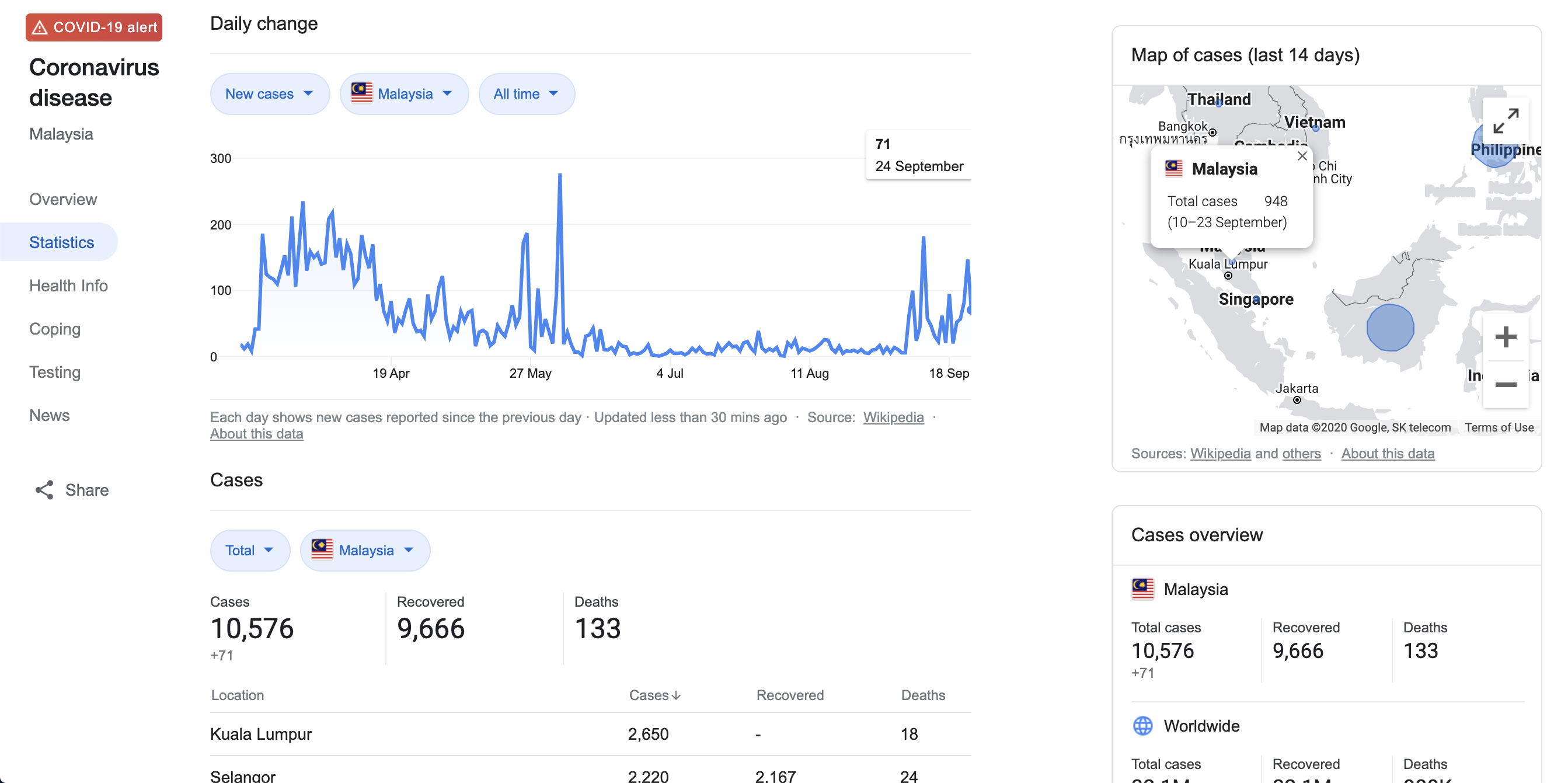
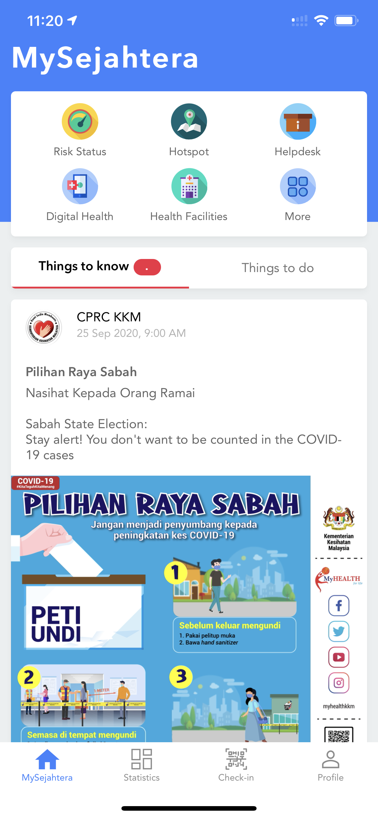
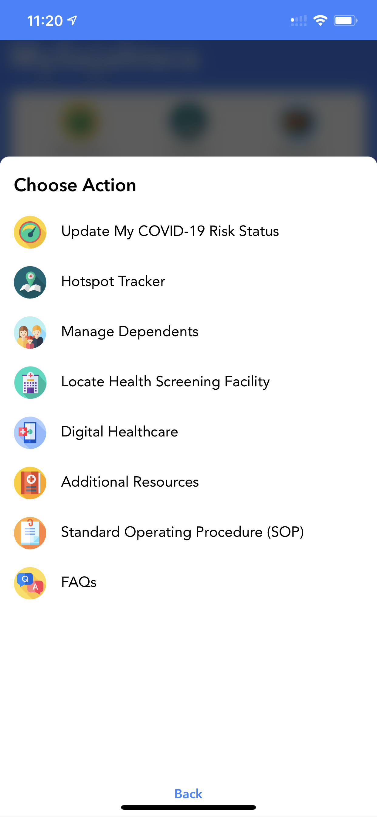
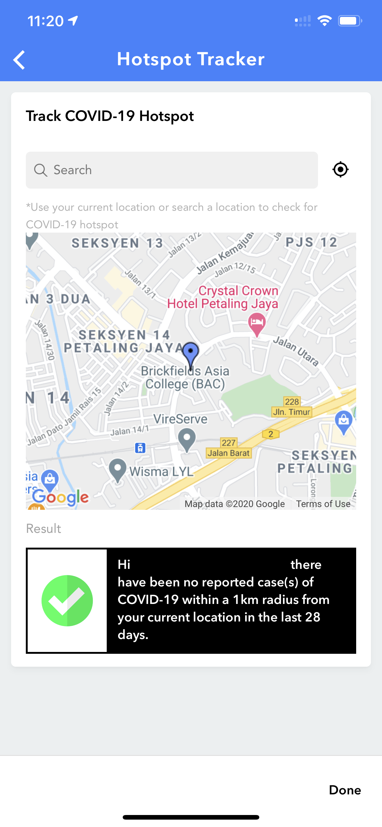
The information can already be seen on Google when you type in “COVID-19 stats (Country name)” in the search bar. From there, you can view the stats, as well as a map with of cases. At the moment you can find out if there are any cases in your area via the MySejahtera app (iOS, Android).

The new upcoming feature will be a good tool to use if you plan on travelling to different states and regions in the country. While we’re allowed to travel within Malaysia during the RMCO, COVID-19 cases are rising. It’s always good to keep updated on the most affected areas.

[ SOURCE, 2 ]

Related reading

The Google Maps app finally returns to the Apple Watch
Tags: covid-19Google Maps
Dzamira Dzafri

Dzamira Dzafri

POPULAR

Google Maps will soon display COVID-19 cases in your area

September 25, 2020
BYD Tech Discovery KL

MITI’s CBU EV ruling will wipe out current EV lineup from BYD, iCaur, Mini, Smart, Toyota, and more

May 7, 2026
Proton EV Plant, Tanjung Malim

MITI says EVs won’t become more expensive, but can Malaysia’s CKD industry fill the gap?

May 10, 2026

Maxis Home Solar now offers outright purchase option, with up to 80% electricity bill savings

May 11, 2026
Rear view of the OPPO Find X9 Ultra in Tundra Umber standing vertically on a stone surface with a lush green bokeh background. The device features an eco-friendly vegan leather back with a classic stitching design , vertically oriented Hasselblad and OPPO logos , and a large circular Master Lens camera module with a bronze-toned knurled ring.

Clearing Every Expectation: How the OPPO Find X9 Ultra Redefines the Modern Flagship Experience

April 16, 2026

The Best Camera is the One You Have with You; The OPPO Find X9 Ultra Wants to be Your Only One

May 6, 2026

Copyright © 2025 · SoyaCincau.com
Mind Blow Sdn Bhd (1076827-P)

  • ADVERTISE
  • DISCLAIMER

Copyright © 2026 · SoyaCincau.com – Mind Blow Sdn Bhd (1076827-P)

  • ADVERTISE
  • DISCLAIMER