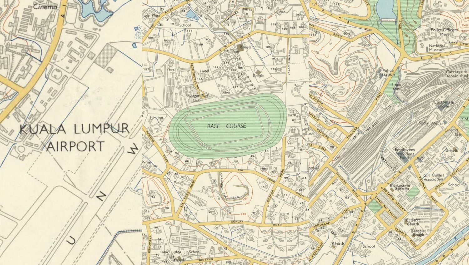
If you’re curious about what Kuala Lumpur was like back in 1957, a good map can give you a better picture of the changes the city has gone through. What was there before the modern buildings dominate the skyline and how the roads we use came to be? Luckily for us, you can walk down memory lane with a high-resolution 1957 map of Kuala Lumpur archived by the Australian National University.
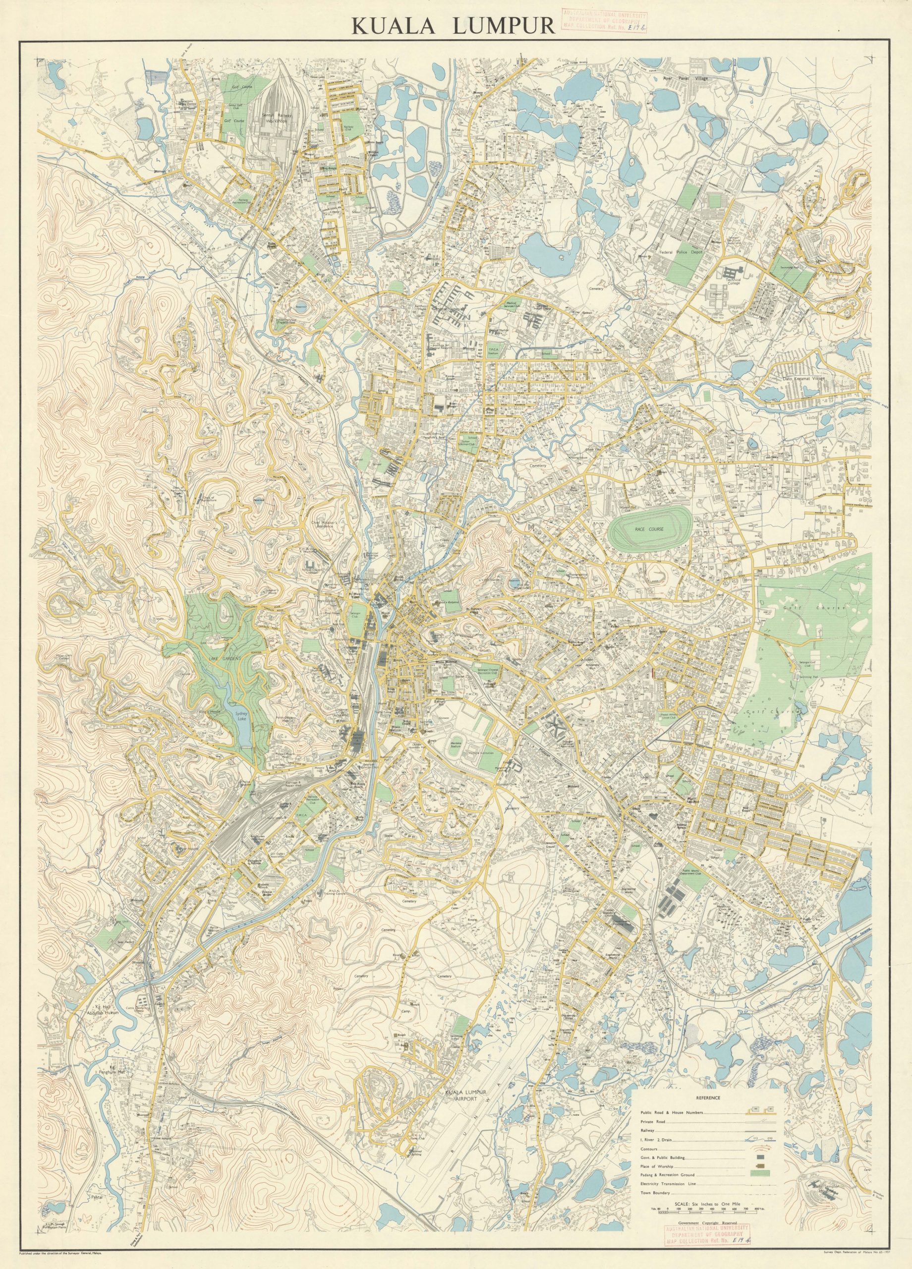
The map was originally published by the Survey Department of the Federation of Malaya in 1957 under the direction of the Surveyor General. The map’s copyright has expired and you can access both high-resolution JPG (10.7MB) and TIFF files (282MB) online.
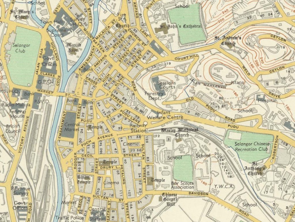
Besides knowing the old street names, you can also see previous buildings and even old railways around the city. In downtown KL, there was previously a Sultan Street railway station near Petaling Street which was later closed down and demolished to make way for Puduraya Bus Terminal (now known as Pudu Sentral today). However, the rail alignment still looks familiar today as it was reused for Star LRT (now known as Ampang and Sri Petaling Lines).
The current Menara Maybank HQ was formerly a Sessions Court and one of the last remaining reminders today is Jalan Bukit Mahkamah.
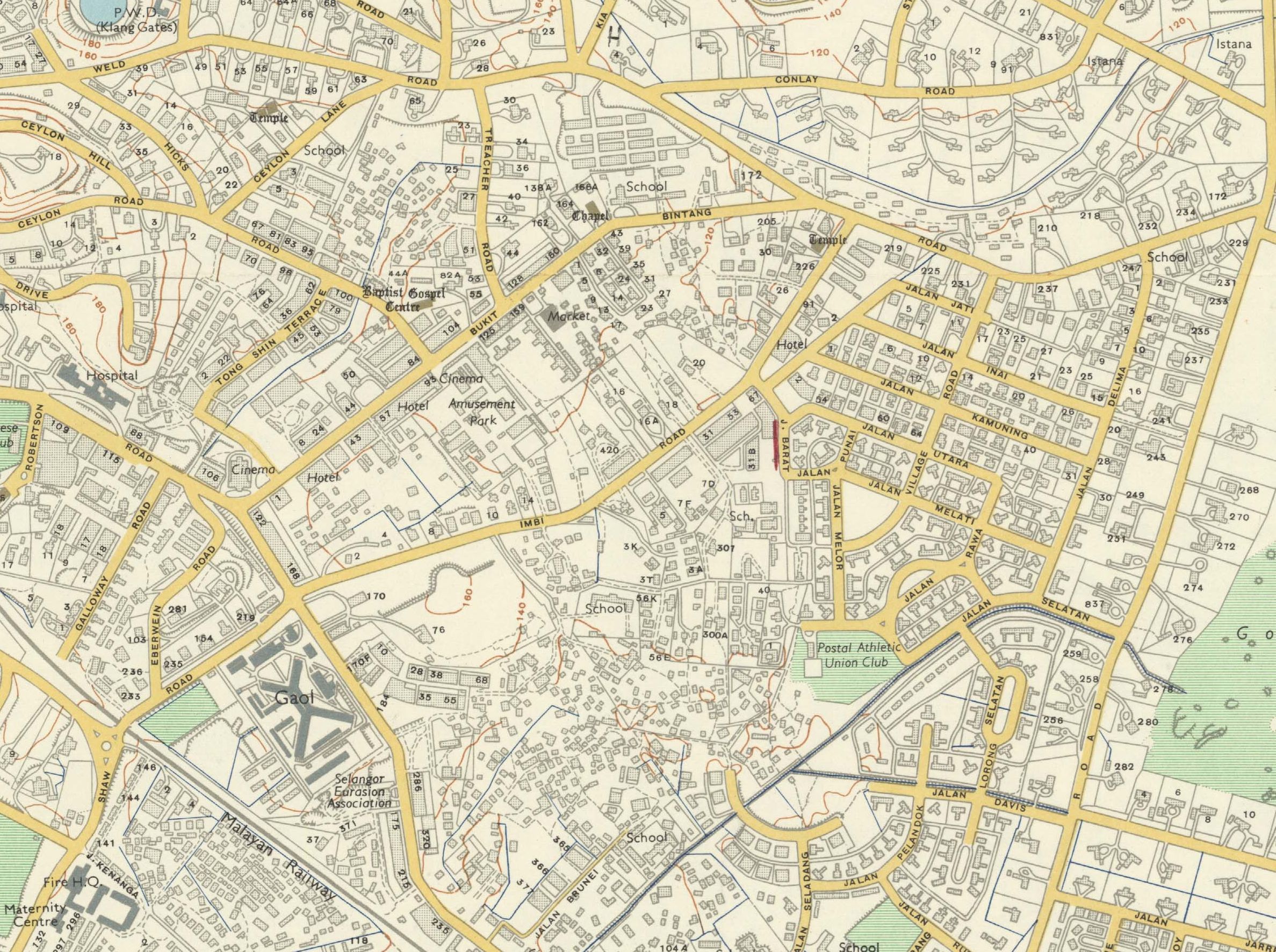
Bukit Bintang looks simpler back then and you can see how Pudu Jail was quite a big landmark before the land was recently redeveloped into Bukit Bintang City Centre (Lalaport) today. Before Sungei Wang and Lot 10, there wasn’t a road connecting Bukit Bintang to Imbi Road in the middle, while Pavilion Bukit Bintang was formerly Bukit Bintang Girls’ School.
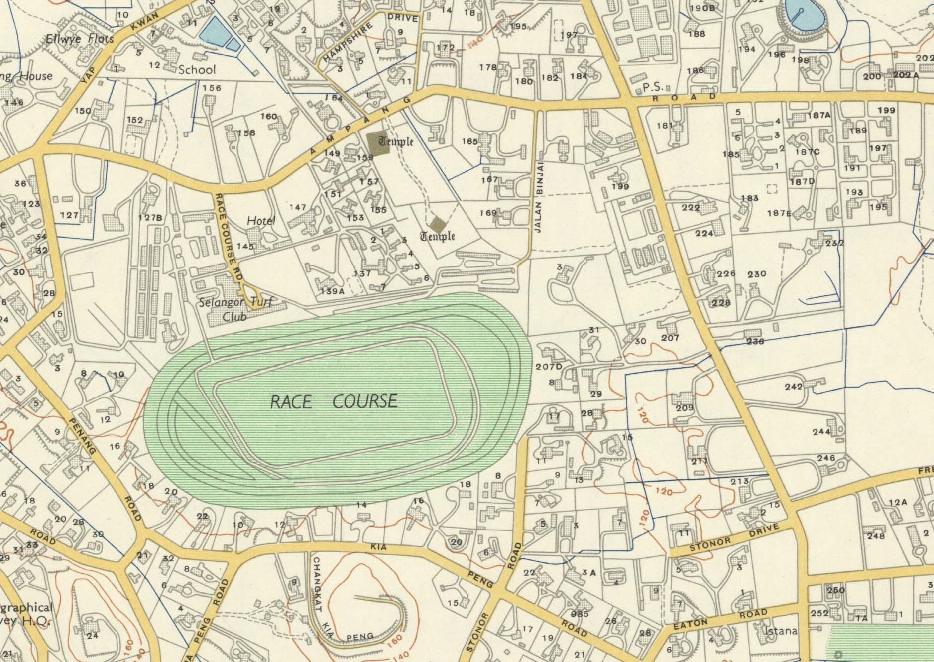
Before we had KLCC, the current land was formerly a race course called the Selangor Turf Club which eventually moved to Serdang in 1993. You can still see some of the old names being retained such as Kia Peng Road, Stonor Drive, Eaton Road, Hampshire Drive and Penang Road.
Kampung Abdullah Hukum is now Apartment Abdullah Hukum. The actual village is now "KL Eco City".
— Hadi Azmi (@amerhadiazmi) May 14, 2023
Kampung Penghulu Mat is gone too, demolished to make way for the Federal Highway.
The Cattle Quarantine Station and Abattoir is where Mid Valley City now sits. pic.twitter.com/EE1Zj9A2tc
As pointed out by Hadi Azmi who shared interesting highlights of the 1957 map via a Twitter thread, the former site of the current KL Sentral was actually a huge KTM railway yard while the KL Eco City across Mid Valley was formerly Kampung Haji Abdullah Hukum. Meanwhile, the current Mid Valley Megamall site used to be a Cattle Quarantine Station and Abattoir. A former village called Kampung Penghulu Mat located south of it was eventually demolished to make way for Federal Highway.
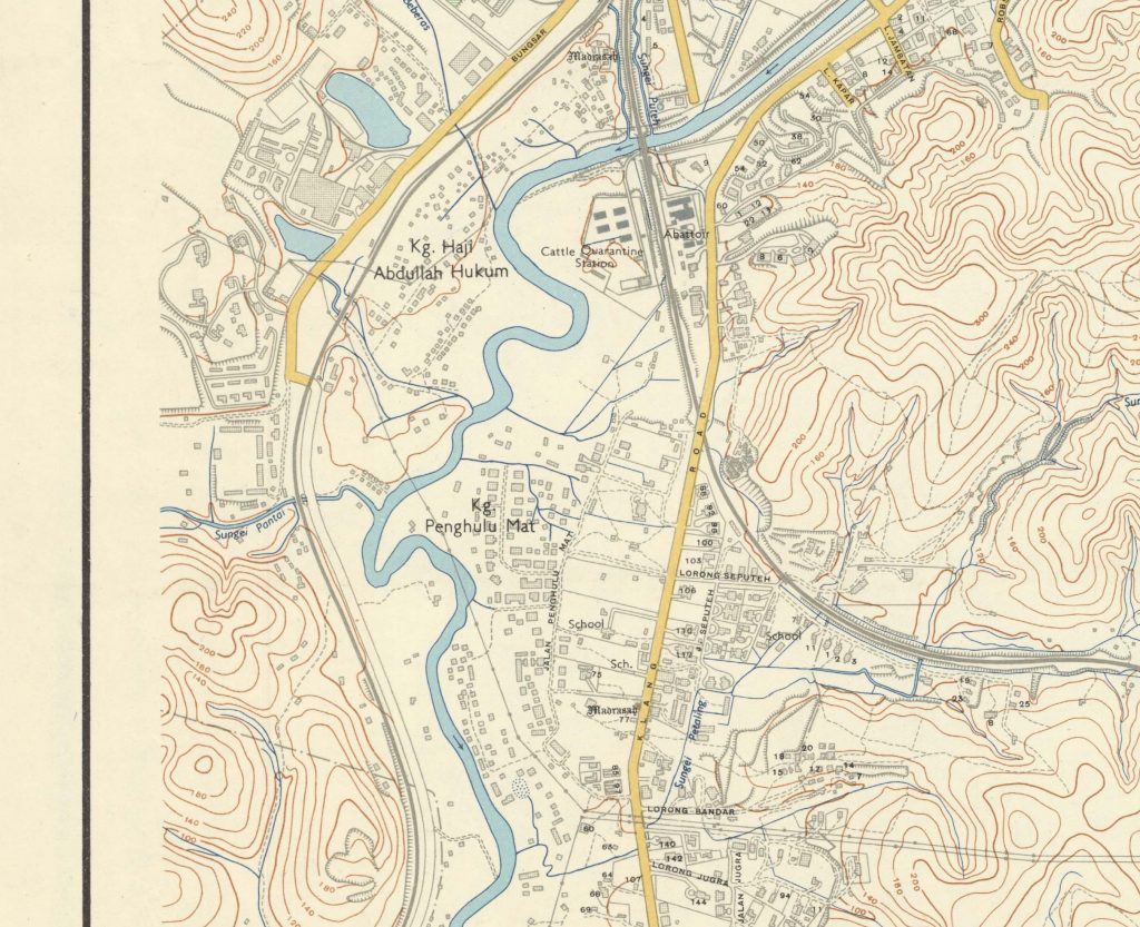
Back then, the only way to travel to Klang was the Old Klang Road and obviously, it was just called Klang Road (without the Old) at the time.
If you’re curious, you can check out the high-resolution map of KL here.