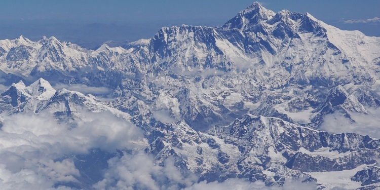
The world’s highest mountain has a new height, and it’s 0.86m higher than previous official calculations. China and Nepal, after disagreements in the past, have finally agreed on the new height—8,848.86m—with Everest standing on the border between the two countries.
The new official height was jointly announced yesterday by the Survey Department of Nepal and Chinese authorities, after the “first serious survey” of the highest point on earth was conducted by a small group of Nepalese surveyors, along with a team from China. Previously, China’s official measurement of Everest’s height was 8,844.43m—around four metres lower than Nepal’s estimate.
Why China and Nepal disagreed in the past
In the past, the main issue of contention was whether to include the snow cap at the summit of Mount Everest in the measurements. China’s stance was that the peak should be measured to its rock height, while their Nepalese counterparts argued that the the overall height of the mountain (including snow) should be measured.
According to the BBC, the Nepalese government decided to remeasure the height of Everest after withstanding pressure from China to accept the lower height as the official measurement. As a result, four experts from Nepal spent two years training for a new mission in 2019, one that would set things straight once and for all. This would be the first time that Nepalese authorities would measure the height of Everest, too.
Damodar Dhakal, a spokesman at Nepal’s Survey Department, told the BBC:
“Before this, we had never done the measurement ourselves. Now that we have a young, technical team, we could do it on our own.”
After China President Xi Jinping’s visit to Nepal in October 2019, it was announced that Chinese and Nepalese officials would cooperate to re-measure the height of Everest. Earlier this year, surveyors sent from China scaled the peak of the world’s heighest peak—and now, we have a new official height for the highest point on earth.
Gorkha earthquake may have affected Everest’s height
Back in 2015, the Gorkha earthquake struck near the city of Kathmandu in Nepal, killing approximately 9,000 residents, with thousands more injured. The earthquake also triggered an avalanche on Mount Everest, reportedly killing at least 19 climbers at Base Camp.
Some geologists believe that the earthquake may have also affected Mount Everest’s height, causing the snow cap at the summit to shrink. This was based on the fact that other peaks in the Himalayas had been reduced in height by the earthquake. On the other hand, others suggest that shifting tectonic plates under Everest may have in fact resulted in a growth in height.
How Everest’s height was re-calculated
Mountains are measured against the average sea level at their bases, which means that a key aspect of the calculations is measuring the “bottom” of the mountain. Nepalese surveyors borrowed information from India for this, while China used the Yellow Sea as a base to make these calculations.
From there, trigonometry formulas were used to estimate the height of the summit, with 12 different peaks (all lower than Everest) used to make the calculations. Then, as mentioned, both Nepal and China sent up teams of surveyors to the summit of Everest at different times to place beacons to complete the measurements.
According to The Guardian, the Foreign Minister of Nepal called Everest an “eternal symbol of friendship between Nepal and China”—and now, they can at least agree on its height.
[ SOURCE , 2 , IMAGE SOURCE ]


